Uploads by Cbeale89
Jump to navigation
Jump to search
This special page shows all uploaded files.
| Date | Name | Thumbnail | Size | Description | Versions |
|---|---|---|---|---|---|
| 12:37, 13 July 2012 | Crozet.jpg (file) |  |
190 KB | made with ArcGIS Explorer and Albemarle County GIS data | 1 |
| 12:24, 13 July 2012 | Neighborhood3Pantops.jpg (file) |  |
176 KB | made with ArcGIS Explorer and Albemarle County GIS data | 1 |
| 12:16, 13 July 2012 | Rural4.jpg (file) |  |
169 KB | made with ArcGIS Explorer and Albemarle County GIS data | 1 |
| 12:12, 13 July 2012 | Rural3.jpg (file) |  |
140 KB | made with ArcGIS Explorer and Albemarle County GIS data | 1 |
| 11:42, 13 July 2012 | Rural2.jpg (file) |  |
155 KB | made with ArcGIS Explorer and Albemarle County GIS data | 1 |
| 11:38, 13 July 2012 | Rural1.jpg (file) |  |
205 KB | made with ArcGIS Explorer and Albemarle County GIS data | 1 |
| 16:52, 5 July 2012 | Stonewall.jpg (file) |  |
187 KB | Image by flickr user OZinOh | 1 |
| 16:47, 5 July 2012 | Rotunda.jpg (file) |  |
123 KB | Image by flickr user Brian J. Geiger | 1 |
| 16:43, 5 July 2012 | CitySpace.jpg (file) |  |
149 KB | Image by flickr user cornexo | 1 |
| 16:28, 5 July 2012 | Cville10k.jpg (file) |  |
125 KB | photo by Michael Hollander, found on flickr | 1 |
| 12:57, 5 July 2012 | Scottsville.jpg (file) |  |
70 KB | created with google maps | 1 |
| 16:48, 2 July 2012 | Fontaine.jpg (file) |  |
76 KB | Fontaine Research Park, published on Charlottesville Tomorrow | 1 |
| 17:38, 27 June 2012 | ResPark.jpg (file) |  |
65 KB | This photo was published on cvilletomorrow.org | 1 |
| 17:34, 27 June 2012 | McIntirePark.jpg (file) |  |
79 KB | this photo was taken by flickr user Small_Realm | 1 |
| 16:22, 19 June 2012 | 19861015RebeccaMcGinness-Interview.MP3 (file) | 43.18 MB | 1 | ||
| 09:28, 1 June 2012 | WoolenMills.jpg (file) |  |
144 KB | my own work made with city of Charlottesvile data and ArcGIS Explorer | 1 |
| 09:26, 1 June 2012 | Venable.jpg (file) |  |
151 KB | my own work made with city of Charlottesvile data and ArcGIS Explorer | 1 |
| 09:25, 1 June 2012 | TheMeadows.jpg (file) |  |
168 KB | my own work made with city of Charlottesvile data and ArcGIS Explorer | 1 |
| 09:23, 1 June 2012 | TenthandPage.jpg (file) |  |
209 KB | my own work made with city of Charlottesvile data and ArcGIS Explorer | 1 |
| 16:14, 31 May 2012 | StarrHill.jpg (file) |  |
148 KB | my own work with help of city data and ArcGIS explorer | 1 |
| 16:14, 31 May 2012 | RoseHill.jpg (file) |  |
163 KB | my own work with help of city data and ArcGIS explorer | 1 |
| 16:13, 31 May 2012 | RidgeStreet.jpg (file) |  |
157 KB | my own work with help of city data and ArcGIS explorer | 1 |
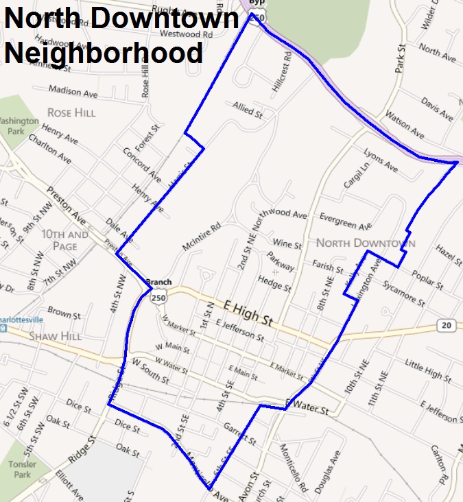
| 16:11, 31 May 2012 | NorthDowntown.jpg (file) |  |
170 KB | my own work with help of city data and ArcGIS explorer | 1 |
| 16:05, 31 May 2012 | MarthaJefferson.jpg (file) |  |
170 KB | my own work with help of city data and ArcGIS explorer | 1 |
| 16:04, 31 May 2012 | JohnsonVillage.jpg (file) |  |
106 KB | my own work with help of city data and ArcGIS explorer | 1 |
| 18:08, 30 May 2012 | LocustGrove.jpg (file) |  |
179 KB | my own work | 1 |
| 18:07, 30 May 2012 | LewisMtn.jpg (file) |  |
130 KB | my own work | 1 |
| 18:04, 30 May 2012 | JeffersonParkAvenue.jpg (file) |  |
154 KB | my own work, data from city of Charlottesville and used ArcGIS Explorer | 1 |
| 18:02, 30 May 2012 | Greenbrier.jpg (file) |  |
155 KB | my own work, made with city of Charlottesville data and ArcGIS Explorer | 1 |
| 16:43, 30 May 2012 | FrysSpring.jpg (file) |  |
182 KB | my own work, data from city of Charlottesville, used ArcGIS Explorer | 1 |
| 16:42, 30 May 2012 | Fifeville.jpg (file) |  |
158 KB | my own work, data from city of Charlottesvile, used ArcGIS | 1 |
| 16:38, 30 May 2012 | Belmont.jpg (file) |  |
206 KB | my own work, data fro city of Charlottesville, made with ArcGIS explorer | 1 |
| 16:36, 30 May 2012 | BarracksRugby.jpg (file) |  |
212 KB | my own work, data from city of Charlottesville, used ArcGIS Explorer | 1 |
| 16:33, 30 May 2012 | BarracksRoad.jpg (file) |  |
180 KB | My work, made with Charlottesville GIS data and ArcGIS Explorer | 1 |
| 14:39, 18 May 2012 | Maplewood.jpg (file) |  |
97 KB | This photo was taken by Flickr user Small_Realm | 1 |
| 14:21, 18 May 2012 | Oakwood.jpg (file) |  |
187 KB | This photo was taken by flickr user miss_leslie on March 16, 2008. | 1 |
| 12:40, 16 May 2012 | ConfMon.jpg (file) |  |
176 KB | This photo was taken by flickr user Jukie Bot on October 11, 2009. | 1 |
| 12:28, 16 May 2012 | UVACemetery.jpg (file) |  |
203 KB | This photo was taken by the flickr user multipletrees on June 13, 2009. | 1 |
| 14:52, 24 April 2012 | UnrestoredMeadowCreek1.jpg (file) |  |
31 KB | A sample of Meadow Creek's current conditions provided by the city of Charlotteville | 1 |
| 14:48, 24 April 2012 | MeadowCreekArtRend1.jpg (file) |  |
41 KB | Vanasse Hangen Brustlin, Inc. artist rendering of what the Meadow Creek could look like after restoration. | 1 |
| 16:03, 19 April 2012 | WestMainSitePlan.jpg (file) |  |
130 KB | Site plan for Marriott Residence Inn provided by Daggett and Grigg Architects | 1 |
| 15:59, 19 April 2012 | MarriottSitePlan.pdf (file) | 1.81 MB | Copy of the site plan for the Marriott Residence Inn provided to the city by Daggett and Grigg Architects. | 1 | |
| 13:21, 19 March 2012 | RobertELee.JPG (file) |  |
110 KB | Photo taken by Billy Hathorn on 7/27/2011 | 1 |
| 11:56, 19 March 2012 | LewisandClark.jpg (file) |  |
549 KB | Photo by jstatad and found on Flickr | 1 |
| 14:22, 15 March 2012 | Shenandoah.jpg (file) |  |
218 KB | Photo by vastateparkstaff, found on flickr | 1 |
| 17:12, 28 February 2012 | JeffersonTheater.jpg (file) |  |
166 KB | This photo was provided by [http://www.flickr.com/photos/mr_t_in_dc/| Mr T in Dc] on Flickr according to Creative Commons licensing | 1 |
| 15:00, 10 February 2012 | Postcensal2010-number.jpg (file) |  |
130 KB | 1 | |
| 14:55, 10 February 2012 | Postcensal2010-percent.jpg (file) |  |
129 KB | 1 |