File:Annexation map cropped shrunk.png
Jump to navigation
Jump to search


Size of this preview: 683 × 600 pixels. Other resolutions: 2,332 × 2,048 pixels | 3,422 × 3,005 pixels.
Original file (3,422 × 3,005 pixels, file size: 6.73 MB, MIME type: image/png)
Summary
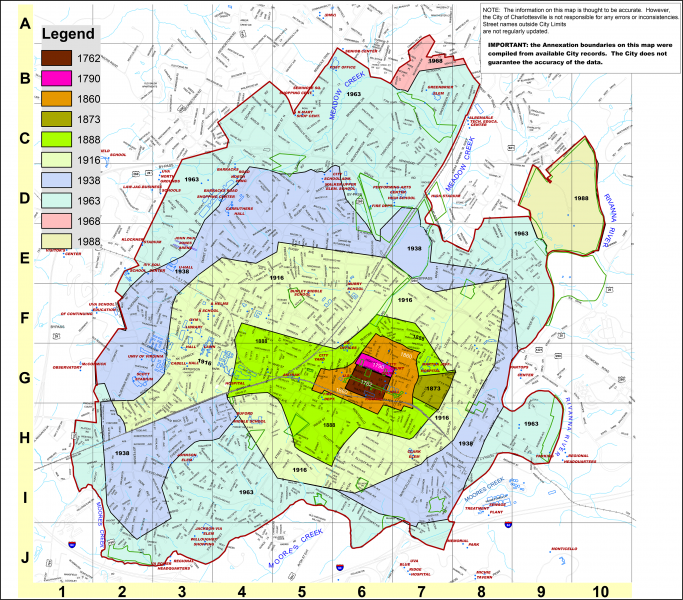
File:Annexation map.pdf, rasterized, cropped, and shrunk below thumbnail limit. Map of city annexations by year, via Jeff Werner
File history
Click on a date/time to view the file as it appeared at that time.
| Date/Time | Thumbnail | Dimensions | User | Comment | |
|---|---|---|---|---|---|
| current | 17:50, 15 January 2019 | | 3,422 × 3,005 (6.73 MB) | Rory096 (talk | contribs) | File:Annexation map.pdf, rasterized, cropped, and shrunk below thumbnail limit. Map of city annexations by year, via Jeff Werner |
You cannot overwrite this file.
File usage
The following page uses this file: