File:1896-Charlottesville Gas Works Sanborn Map Company, Dec 1896.JPG
Jump to navigation
Jump to search

Size of this preview: 737 × 599 pixels. Other resolution: 835 × 679 pixels.
Original file (835 × 679 pixels, file size: 58 KB, MIME type: image/jpeg)
Summary
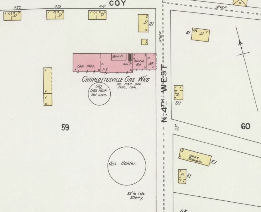
https://www.loc.gov/resource/g3884cm.g3884cm_g089951896/?sp=1&r=-0.653,-0.213,2.305,1.098,0 Title: Sanborn Fire Insurance Map from Charlottesville, Independent Cities, Virginia. Created / Published: Sanborn Map Company, Dec 1896 Repository: Library of Congress Geography and Map Division Washington, D.C. 20540-4650 USA Digital Id: http://hdl.loc.gov/loc.gmd/g3884cm.g3884cm_g089951896
Licensing
File history
Click on a date/time to view the file as it appeared at that time.
| Date/Time | Thumbnail | Dimensions | User | Comment | |
|---|---|---|---|---|---|
| current | 15:06, 16 March 2019 | | 835 × 679 (58 KB) | Jmh6d (talk | contribs) | https://pdfs.semanticscholar.org/d129/9343dd77b33bc6b3f782cce21507ab1ae2e6.pdf https://www.loc.gov/resource/g3884cm.g3884cm_g089951896/?sp=1&r=-0.653,-0.213,2.305,1.098,0 Title: Sanborn Fire Insurance Map from Charlottesville, Independent Cities, Virgi... |
You cannot overwrite this file.
File usage
The following page uses this file: